Albania for Cooler Escapes: High Valleys, Mountain Villages and Alpine Roads
Albania’s strongest summer cooling pattern sits above the Adriatic lowlands: deeply cut northern valleys, Kelmend villages near the Montenegrin border, and high settlements around Korçë. Theth, Valbona, Vermosh, Lëpushë, Razëm, Dardhë and Voskopojë offer meaningful altitude and cooler nights, but road time, limited local transport and peak-season pressure differ sharply between them.
Four northern Albanian Alps routes, one Shkodër forest base and two high villages in Korçë County.
Its approximate 1,260 m base and exposed Kelmend setting produce the coolest daytime proxy in the route set.
Lëpushë, Voskopojë and Dardhë place accommodation within a high-ground band rather than requiring a long ascent each day.
The July–August route median favors open-window evenings, although individual heat events can still lift night temperatures.
Dardhë and Voskopojë are easier to organize from one regional city base than the longer northern valley approaches.
July and August concentrate guesthouse demand, trail traffic and transfer pressure in the two most recognized alpine valleys.
High Valleys and Mountain Villages Across Albania
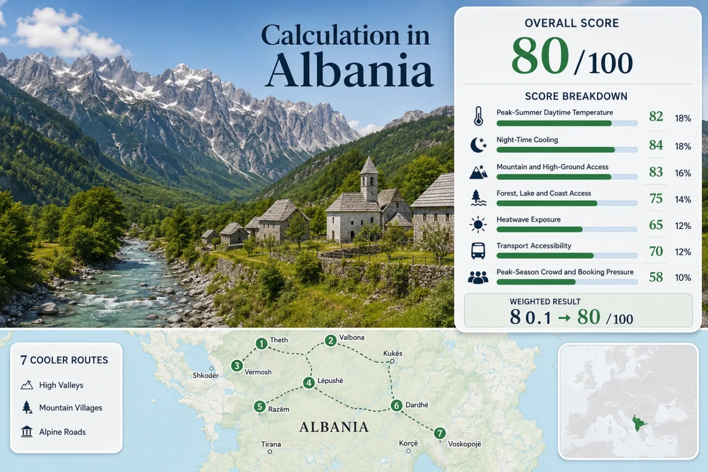
The route set runs from the Shala and Valbona valleys to the Kelmend highlands, then shifts south to the Korçë mountain villages. The map shows planning centers rather than trailheads, legal parking places or exact viewpoints.
Markers use approximate public settlement centers for planning orientation. Confirm current roads, transfer points, trail access and parking conditions through local operators before travel.
Albania High-Valley Cooler Escape Suitability Score
This transparent editorial suitability index uses disclosed climate, landscape, access and pressure factors for the seven routes shown on the map. It is not an official climate classification or a weather forecast.
Weighted total: 79×0.25 + 100×0.20 + 100×0.15 + 75×0.15 + 80×0.10 + 40×0.10 + 80×0.05 = 82.0 → 82/100
Each route carries equal weight within a factor, and route count does not increase the total. Factor medians limit the influence of a single exceptionally cool or accessible place. Read the Cooler Escape scoring methodology.
Seven Albanian Mountain Bases for Peak-Summer Relief
The route portfolio separates places that are genuinely high from valleys that rely on nearby relief. Temperature figures are rounded route-center proxies for comparison, not live forecasts or promises of cool weather.
Theth and the Upper Shala Valley
Theth works through relief rather than extreme settlement altitude. The village sits below steep limestone walls, with forested side valleys and higher trail terrain close to accommodation. The July–August proxy daytime value is milder than Albania’s lowland cities, while nights usually provide a larger comfort reset.
Access: The Qafë Thorës approach includes exposed bends and a steep descent into the valley. Distances look short on a map but travel time is governed by mountain-road speed and peak-season traffic. Watch for: Guesthouse availability and parking pressure in July and August.
Valbona River Valley
Valbona places guesthouses along a broad glacial valley approximately 23 km from Bajram Curri. Its river corridor and immediate high peaks create strong mountain access, but the valley’s reputation concentrates demand during the main hiking window.
The route can be reached by road through northeastern Albania or folded into the Koman–Fierza ferry chain. The ferry version is scenic but makes the day dependent on transfer and sailing schedules. The official tourism authority reports heavy summer visitation, so booking ahead is more important here than in Vermosh or Lëpushë.
Vermosh in the Upper Kelmend Valley
Vermosh is Albania’s northernmost substantial mountain-village base, reached through the SH20 corridor and the Kelmend highlands. The settlement is high enough to receive a meaningful night-cooling benefit without requiring a daily climb from a lowland hotel.
Good for: Travelers prioritizing space, river-valley walking and a slower multi-night stay. The trade-off is a long approach from Shkodër and limited flexibility without a car or arranged transfer.
Lëpushë and the Kelmend Highlands
Lëpushë has the clearest low-heat profile in the seven-route set. Accommodation sits within a high basin rather than on a hot valley floor, and nearby forest and open upland terrain make short cooling walks possible without a lengthy vehicle transfer.
Services are smaller in scale than Theth or Valbona, so the route rewards a planned stay rather than spontaneous late arrival. Main caution: Mountain storms, cloud and road conditions can change quickly despite a mild climatological average.
Razëm Forest Base Above the Shkodër Plain
Razëm is less dramatic than the major alpine valleys, yet it solves a different planning problem: reaching a forested high base from the Shkodër–Koplik corridor without committing to the full Theth or Kelmend road day. It is suited to short stays and heat-wave backup planning.
Daytime conditions can be warmer than Lëpushë or Voskopojë, but shade and a 900 m lodging band still provide a substantial contrast with the plain. Weekend demand is more relevant than broad week-long capacity pressure.
Dardhë on the Korçë Mountain Road
Dardhë combines the highest approximate accommodation base in the route set with a relatively short connection from Korçë. Daytime proxies are not the lowest because southeast Albania can still receive strong continental summer heat, but the high village position supports reliable night relief.
Works for: A two-base trip that keeps urban services in Korçë and shifts sleeping hours into the mountains. The final road is winding, and scheduled local transport is less dependable than a private transfer.
Voskopojë’s High Plateau and Pine Forests
Voskopojë produces the strongest night-cooling profile in the portfolio while retaining a wider lodging and restaurant base than the smaller Kelmend villages. Its plateau setting and pine forests make it easier to build a comfortable morning-and-evening rhythm around warmer midday hours.
The road connection from Korçë is straightforward by Albanian mountain standards. Peak weekends can fill popular guesthouses, but the route remains logistically simpler than Theth, Valbona or Vermosh.
Qafë Thorës and SH20 Create Two Different Northern Road Days
The northern route choice is not simply Theth versus Kelmend. It is a choice between a steep pass-and-valley descent and a longer corridor that gains altitude through Tamarë before dividing toward Vermosh and Lëpushë.
Theth Through Qafë Thorës
Theth’s paved approach removes the old unsealed-road barrier, but it does not make the road lowland-fast. The pass, switchbacks and final valley descent reward daylight driving and conservative timing. A single overnight can feel rushed when arrival and departure both consume prime hiking hours.
Kelmend Through the SH20 Corridor
SH20 carries travelers north through the Cem valley to Tamarë before local roads continue toward the high villages. The main corridor is easier to read than the Theth descent, yet Vermosh and Lëpushë remain far enough from Shkodër to justify at least two nights. Fuel, food and arrival time are better settled before the final branch roads.
Valbona’s Koman–Fierza Chain Trades Heat for Timetable Dependence
The Shkodër–Koman–Fierza–Bajram Curri–Valbona sequence turns the transfer into a full travel day. It combines a road leg, lake crossing and onward vehicle connection, so a missed departure can affect the entire chain. The alternative road approach through northeastern Albania is less dependent on a sailing but can be longer depending on the starting point.
Decision point: Choose the ferry chain when the lake journey is part of the trip and fixed timing is acceptable. Choose the road approach when luggage, late arrival or schedule flexibility matters more. Published sailing times, vehicle space and onward transfers should be reconfirmed for the exact date rather than assumed from a previous season.
Korçë Makes Dardhë and Voskopojë Easier to Pair
Southern Albania’s high-village circuit is less isolated than the northern valleys because both mountain bases connect back to Korçë, where regional buses, taxis, restaurants and larger accommodation supply simplify logistics.
Use Dardhë for Altitude
Dardhë’s approximate 1,340 m base gives the circuit its strongest built-in elevation. Staying overnight matters more than making a warm-afternoon day trip because the cooling advantage is clearest after sunset and before late morning.
Use Voskopojë for Cooler Nights and Services
Voskopojë combines a lower proxy minimum with a broader guesthouse and dining base. It is the more forgiving choice for travelers who want mountain air without the limited-service character of Lëpushë or Vermosh.
Keep Korçë as the Service Anchor
Korçë can hold rental-car pickup, onward buses and supplies while the mountain villages handle the cooler sleeping hours. The arrangement is useful when weather changes make a fixed multi-day hiking plan less attractive.
Seven Routes Compared by Heat, Height and Access
The comparison uses the same seven routes as the map, score and route cards. Approximate elevations and rounded climate proxies support route selection but should not replace a current forecast or local road check.
| Route | Approximate lodging base | July–August proxy high / low | Practical access pattern | Main pressure point |
|---|---|---|---|---|
| Theth | 750 m | 24.0°C / 12.5°C | Qafë Thorës mountain road; seasonal transfers | Guesthouses, trail traffic and parking |
| Valbona | 950 m | 24.5°C / 14.5°C | Road via Bajram Curri or Koman–Fierza chain | Summer visitation and transfer capacity |
| Vermosh | 1,000 m | 24.5°C / 14.5°C | Long SH20 and Kelmend approach | Limited service rather than heavy crowds |
| Lëpushë | 1,260 m | 22.5°C / 12.5°C | SH20 corridor plus local mountain road | Small accommodation and dining supply |
| Razëm | 900 m | 25.0°C / 14.5°C | Shorter road from the Shkodër–Koplik axis | Weekend demand |
| Dardhë | 1,340 m | 25.5°C / 12.5°C | Approximately 20 km by road from Korçë | Winding access and limited scheduled service |
| Voskopojë | 1,160 m | 23.5°C / 10.5°C | Direct regional road from Korçë | Popular weekend guesthouses |
June, Peak Summer and Early September Serve Different Plans
Road access, trail condition, guesthouse capacity and night temperature do not peak at the same time. The practical window depends on whether the priority is the lowest heat, the widest hiking access or fewer bookings.
June for Quieter Roads and Green Valleys
June generally reduces booking pressure in Theth and Valbona and keeps rivers and vegetation visually active. Higher routes can still hold snow, mud or storm-related disruption, so long pass hikes require current local confirmation.
July–August for Full Alpine Access
The main hiking window offers the most reliable high-trail access and the broadest guesthouse operation. It also brings the warmest afternoons, the strongest Theth–Valbona demand and the greatest need to reserve transfers.
Early September for Cooler Nights
Early September often preserves workable roads and open lodging while lowering night temperatures and visitor pressure. Shorter daylight makes late arrivals on Qafë Thorës, Kelmend branches or the Valbona transfer chain less forgiving.