Africa does not have one shared “summer” pattern. The strongest mild-weather routes come from East African elevation, southern highlands, Atlantic influence, mountain plateaus and Southern Hemisphere seasonality. The continent view is therefore organized around climate mechanism and travel season rather than latitude alone.
Match the route to the right seasonal window
June–August can be a cool or dry-season advantage in several eastern and southern routes, while January–February is the relevant warm-season test for Southern Hemisphere destinations such as South Africa. Equatorial highlands need a separate reading of rain, cloud and road conditions. The country guide is the final reference for the exact scoring window.
Highest Cooler Escape Scores in this region
These are the strongest currently published route portfolios in the continent category. Open a guide to see the factor weights, source notes and route-level calculation.
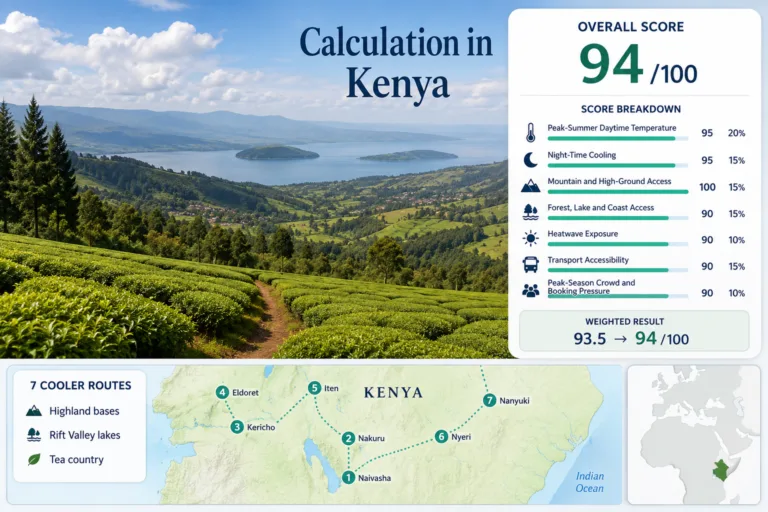
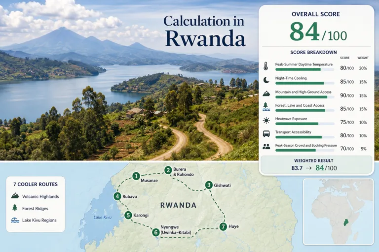
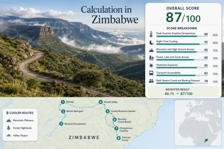
Zimbabwe Eastern Highlands
Night-Time Cooling · Mountain and High-Ground Access
Open the route guide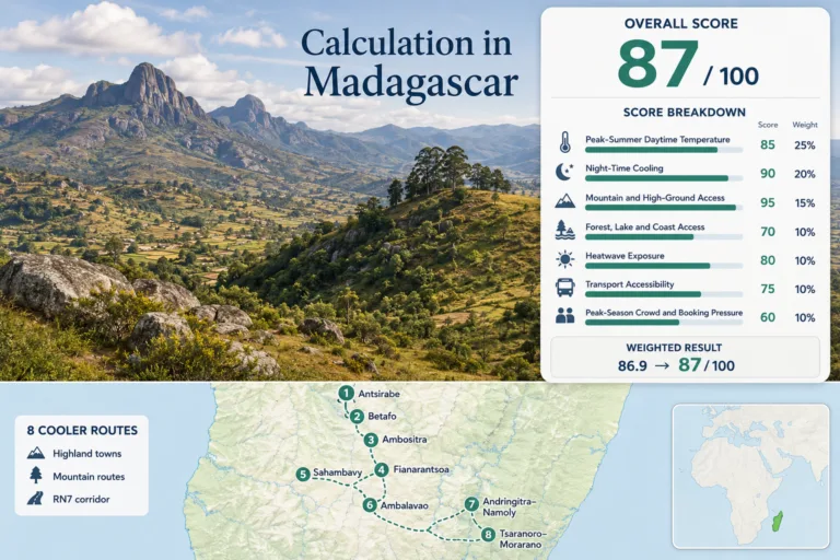
High ground and season choice matter more than the continent label
Nairobi-area highlands, the Ethiopian and Rwandan uplands, Lesotho and South African escarpments all use elevation differently. Atlantic islands and coastal routes rely more on marine moderation. A useful Africa coolcation comparison has to state whether it is describing Northern Hemisphere summer, equatorial seasonality or Southern Hemisphere winter and summer conditions.
Africa’s main mild-weather route groups
These groups organize countries by the geography that changes summer comfort, not simply by political borders.
East African highlands
Southern African highlands
Atlantic & island influence
North African mountains
Compare African routes by the factor that changes the trip
The same seven-factor scoring model can be read from different angles. These shortlists use the published factor values rather than a separate editorial ranking.
Daytime relief
Peak-Summer Daytime TemperatureNight cooling
Night-Time CoolingHigh-ground access
Mountain and High-Ground AccessLower crowd pressure
Peak-Season Crowd and Booking PressureAll Africa mild-weather guides
Use the individual guides for route maps, source-level climate evidence, access cautions and the complete score calculation.
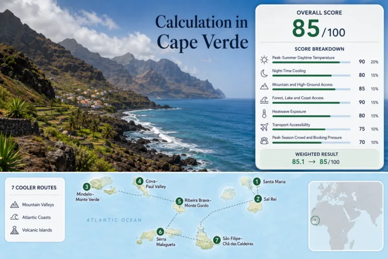
Cape Verde for Breezier Island Travel: Mountain Valleys, Trade Winds and Atlantic Air
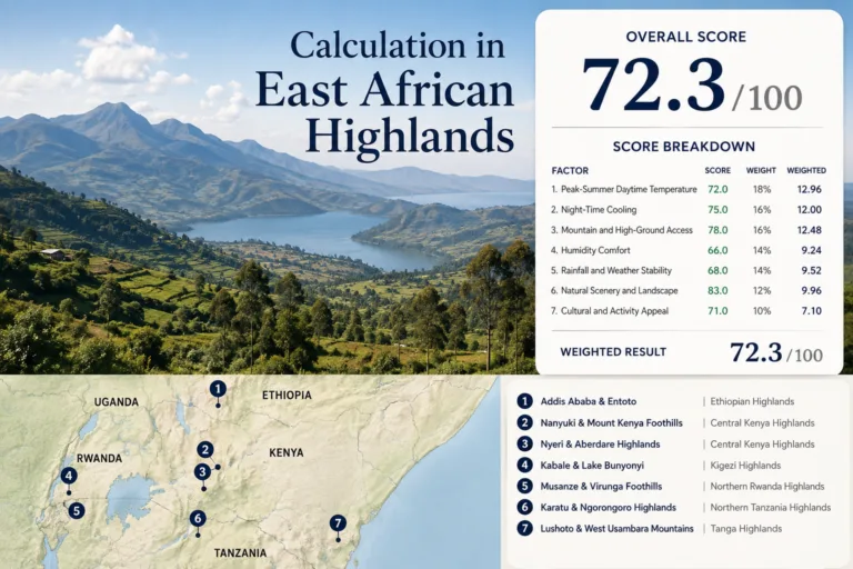
East African Highlands for Cooler Travel
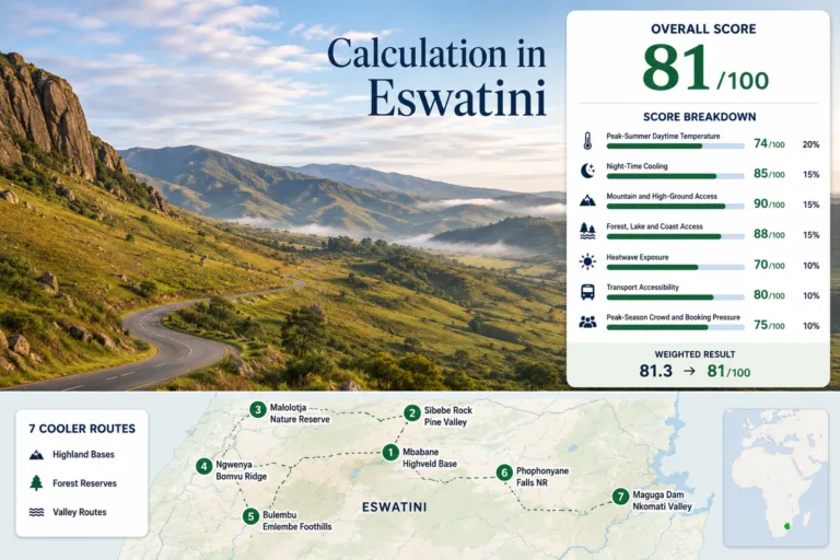
Eswatini Highland Escapes: Mountain Roads, Forest Reserves and Cool Valley Mornings
Kenya Highland Cooldowns: Rift Valley Lakes, Tea Country and Mountain Air
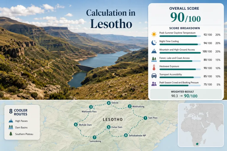
Lesotho Coolcation Routes: High Passes, Mountain Dams and Kingdom-in-the-Sky Air
Madagascar Highland Routes: Antsirabe, Granite Massifs and Cool Central Towns
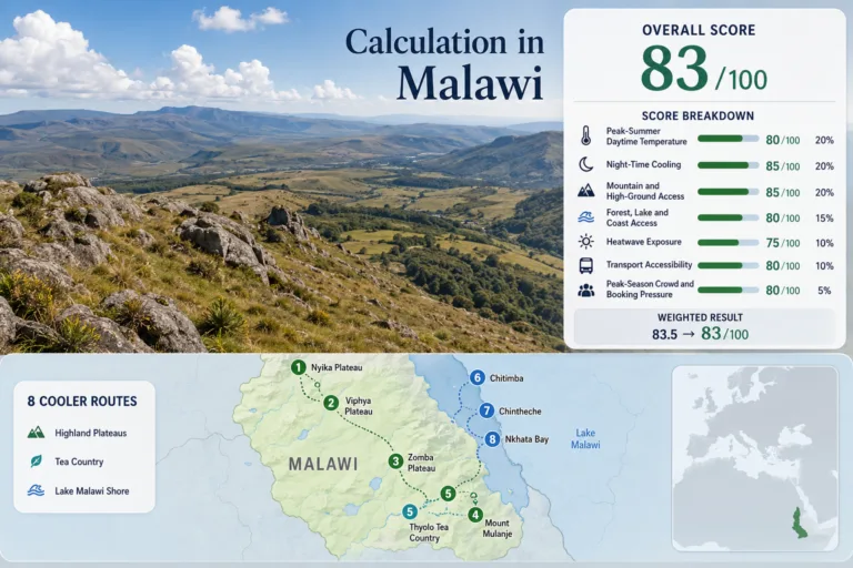
Malawi Highland Escapes: Nyika Plateau, Tea Country and Lake Breezes
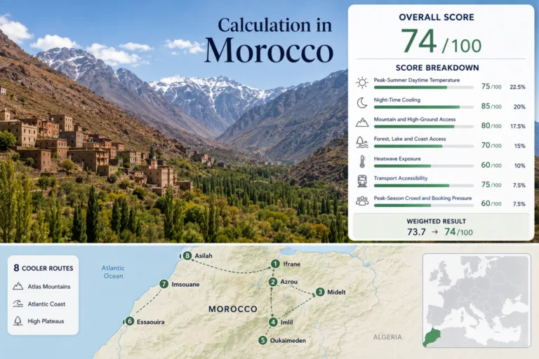
Morocco Beyond the Summer Heat: Atlas Villages, Atlantic Towns and High Valleys
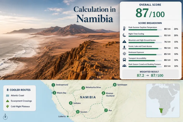
Namibia Cool Dry-Season Routes: Desert Plateaus, Atlantic Fog and Clear Cold Nights
Rwanda for Mild Highland Travel: Volcano Lakes, Forest Roads and Hill-Country Air
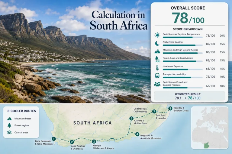
South Africa Mild-Season Routes: Mountain Regions, Coastal Air and Cooler Landscapes
Plan South Africa mild-season routes through Drakensberg passes, Cape coastal air and 18–24°C days across cooler...
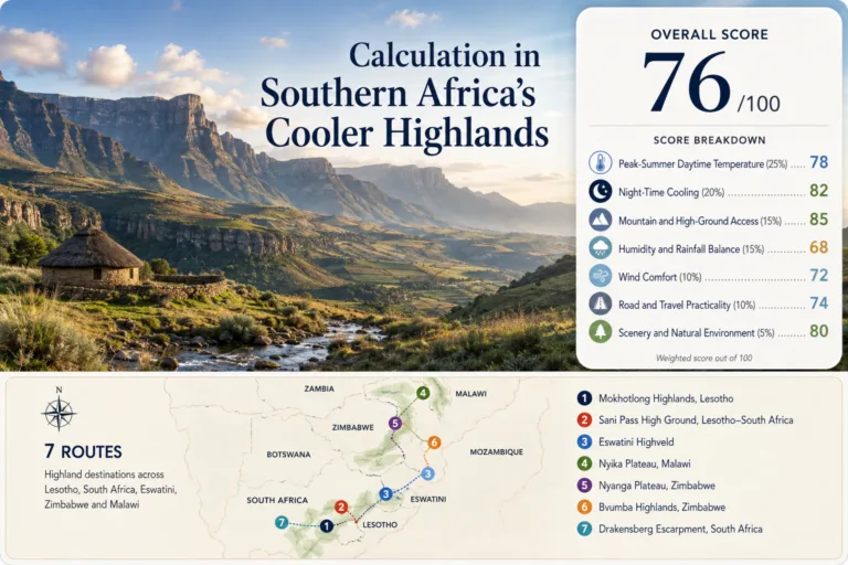
Southern Africa’s Cooler Highlands
Southern Africa’s Cooler Highlands Southern Africa’s strongest relief from lowland heat is often found by gaining...
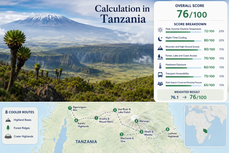
Tanzania Beyond the Coastal Heat: Northern Highlands, Crater Rims and Mountain Towns
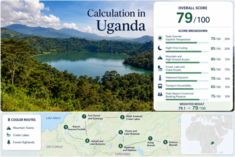
Uganda Highland Escapes: Crater Lakes, Mountain Forests and Cool Western Towns
Zimbabwe Cooler Landscapes: Eastern Highlands, Forest Roads and Mountain Retreats
15 articles in Africa
One scoring framework, different route portfolios
The Cooler Escape Score combines peak-summer daytime temperature, night-time cooling, mountain access, forest/lake/coast access, heatwave exposure, transport accessibility and peak-season crowd pressure. A continent pillar summarizes the published country and region route sets; it does not replace the evidence on each destination page.