Escape the Summer Heat Smarter
Compare cooler summer destinations using climate, elevation, coasts, forests, heat exposure, crowd pressure and transport access.
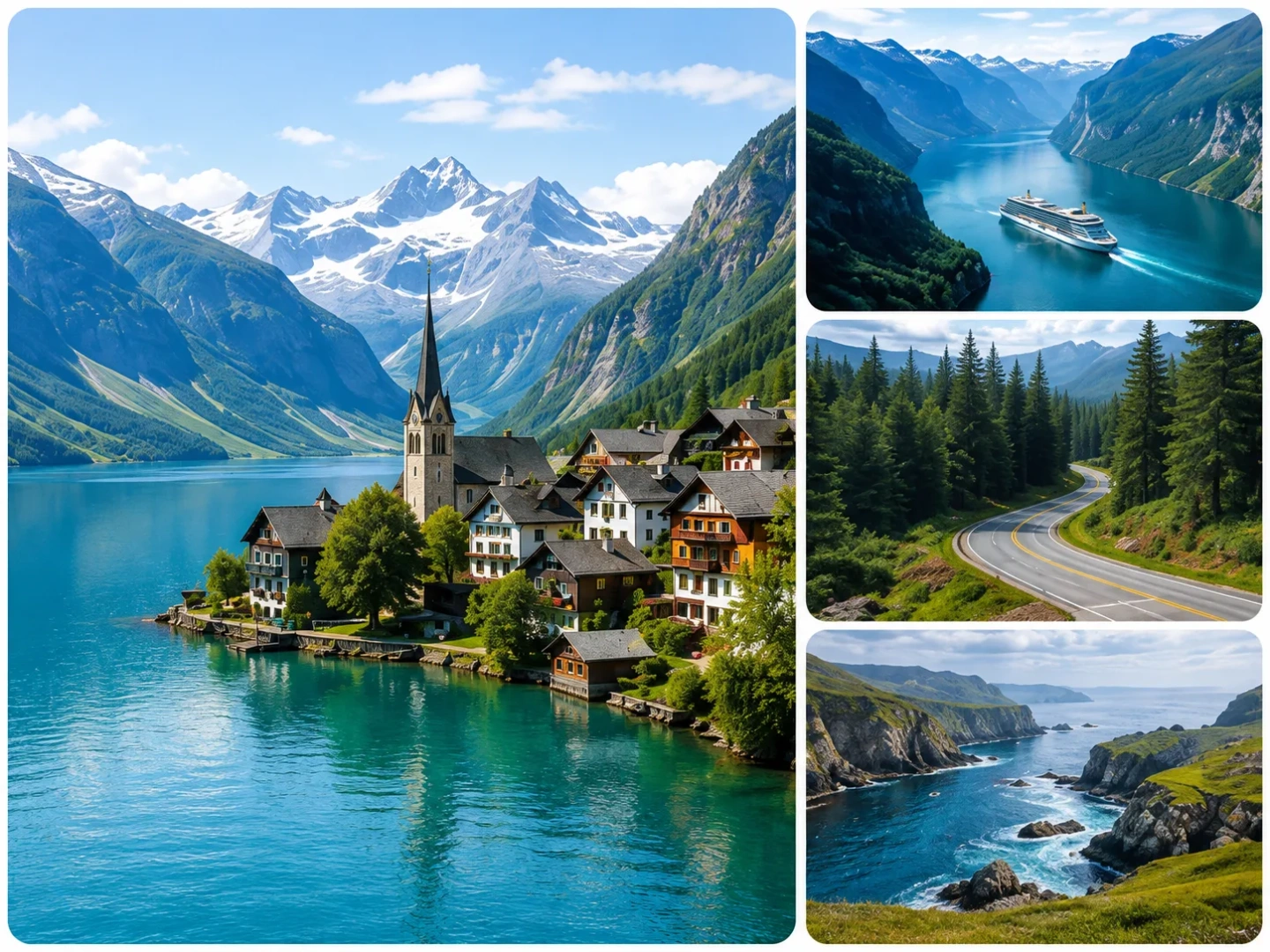
Top Cooler Escape Scores
A quick view of the strongest currently published route portfolios. Each score uses the same seven-factor methodology.
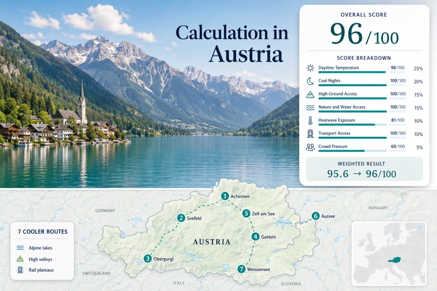
Alpine lakes, mountain shade and high-valley summer routes.
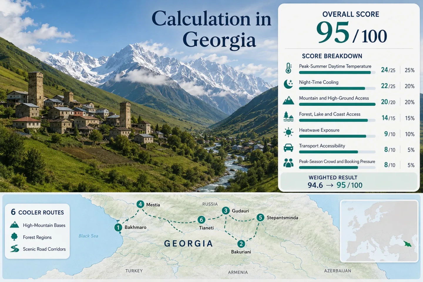
Caucasus villages, high valleys and mountain-road escapes.
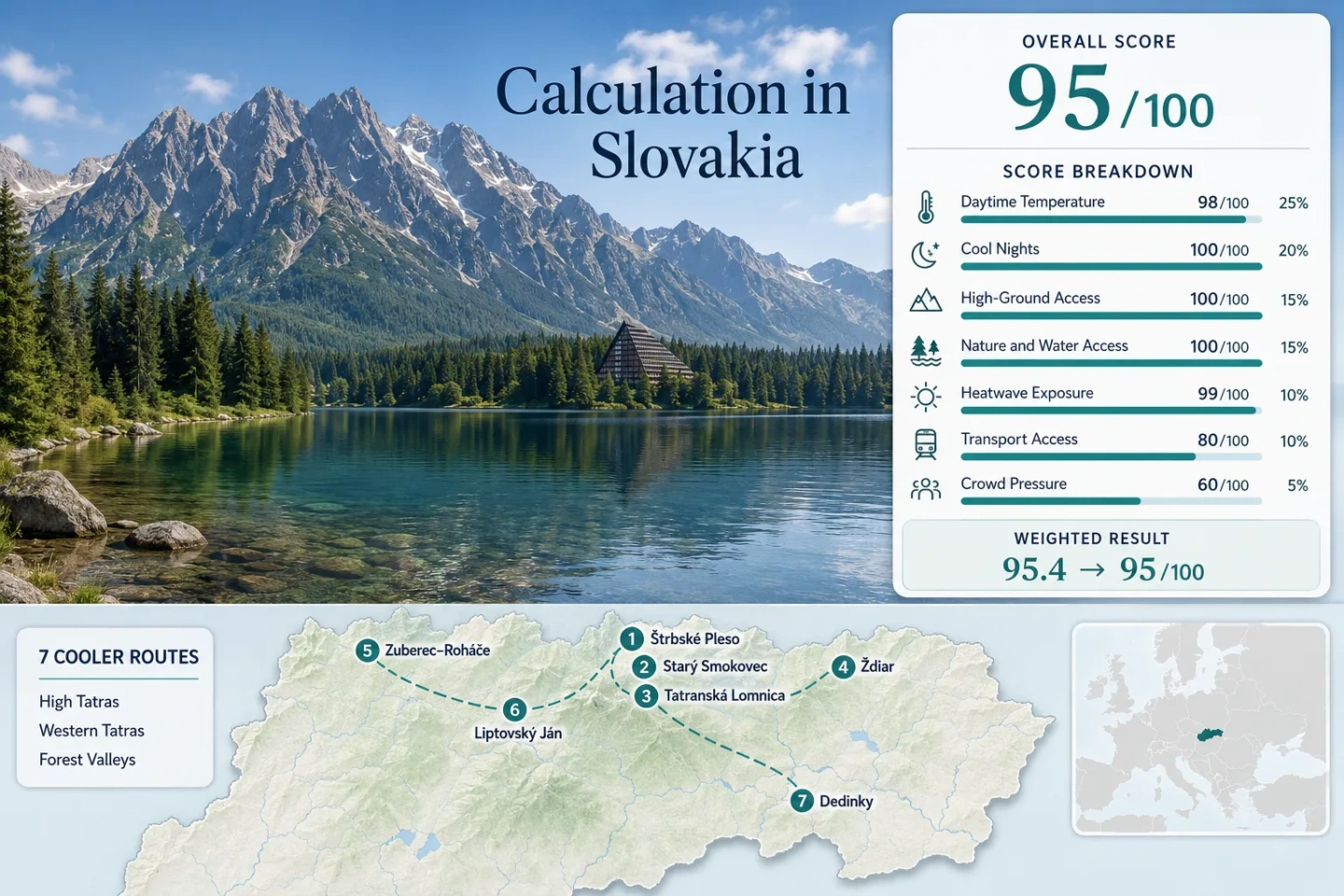
High Tatras, forest valleys and strong overnight cooling.
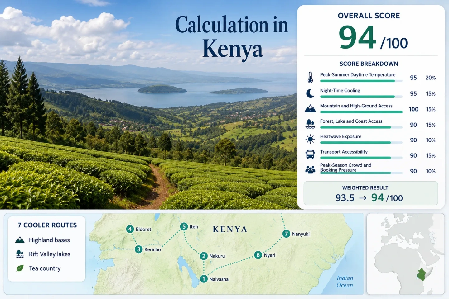
Rift Valley lakes, tea country and elevated mountain-air routes.
Start With the Landscape That Cools the Trip
Elevation, moving sea air, lake influence, forest cover and reliable night cooling are the recurring physical advantages.
Alpine Lakes & High Villages
Elevation, clear water and cooler nights around mountain bases.
Fjords & Atlantic Air
Cool seas, exposed coasts, fjord water and refreshing winds.
Highlands, Forests & Mountain Roads
Shade, elevation and route options that move inland and uphill.
Islands & Breezy Coasts
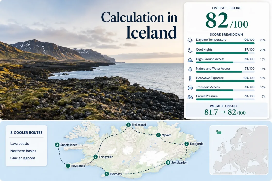
Ocean exposure, steady breezes and lower heat stress.
Plan by Map, Not Guesswork
Real placesActual towns, parks, valleys and route bases.
Route clustersCountry pages organize practical multi-stop patterns.
Seasonal notesBest windows, access constraints and forecast risk.
Comparison tablesSide-by-side score and route context.
Why the Score Feels Trustworthy
Every destination is compared through the same seven weighted factors, with source notes, review dates and a stated methodology version.
🇳🇴 Norway
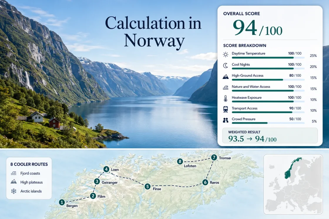
94 / 100Fjord towns, high roads, Arctic islands and long summer days.
Norway shows what CoolerEscapes should communicate at a glance: the score is not just “cold weather.” It combines route-level climate, high-ground access, water influence, transport practicality and seasonal pressure.
All Cooler Escape Scores
Browse the complete published ranking and open the full calculation for each destination.
Showing 10 of 102 countries and regions
How this score was calculated
- Peak-Summer Daytime Temperature98/10025% weight
- Night-Time Cooling100/10020% weight
- Mountain and High-Ground Access100/10015% weight
- Forest, Lake and Coast Access100/10015% weight
- Heatwave Exposure81/10010% weight
- Transport Accessibility100/10010% weight
- Peak-Season Crowd and Booking Pressure60/1005% weight
Weighted result: 95.6 → 96/100
View the full calculationHow this score was calculated
- Peak-Summer Daytime Temperature100/10025% weight
- Night-Time Cooling98/10020% weight
- Mountain and High-Ground Access100/10015% weight
- Forest, Lake and Coast Access100/10015% weight
- Heatwave Exposure89/10010% weight
- Transport Accessibility80/10010% weight
- Peak-Season Crowd and Booking Pressure60/1005% weight
Weighted result: 94.5 → 95/100
View the full calculationHow this score was calculated
- Peak-Summer Daytime Temperature98/10025% weight
- Night-Time Cooling100/10020% weight
- Mountain and High-Ground Access100/10015% weight
- Forest, Lake and Coast Access100/10015% weight
- Heatwave Exposure99/10010% weight
- Transport Accessibility80/10010% weight
- Peak-Season Crowd and Booking Pressure60/1005% weight
Weighted result: 95.4 → 95/100
View the full calculationHow this score was calculated
- Peak-Summer Daytime Temperature95/10025% weight
- Night-Time Cooling100/10020% weight
- Mountain and High-Ground Access100/10015% weight
- Forest, Lake and Coast Access100/10015% weight
- Heatwave Exposure90/10010% weight
- Transport Accessibility80/10010% weight
- Peak-Season Crowd and Booking Pressure60/1005% weight
Weighted result: 93.8 → 94/100
View the full calculationHow this score was calculated
- Peak-Summer Daytime Temperature100/10025% weight
- Night-Time Cooling100/10020% weight
- Mountain and High-Ground Access80/10015% weight
- Forest, Lake and Coast Access100/10015% weight
- Heatwave Exposure100/10010% weight
- Transport Accessibility90/10010% weight
- Peak-Season Crowd and Booking Pressure50/1005% weight
Weighted result: 93.5 → 94/100
View the full calculationHow this score was calculated
- Peak-Summer Daytime Temperature100/10025% weight
- Night-Time Cooling88/10020% weight
- Mountain and High-Ground Access100/10015% weight
- Forest, Lake and Coast Access88/10015% weight
- Heatwave Exposure100/10010% weight
- Transport Accessibility100/10010% weight
- Peak-Season Crowd and Booking Pressure60/1005% weight
Weighted result: 93.8 → 94/100
View the full calculationHow this score was calculated
- Peak-Summer Daytime Temperature98/10025% weight
- Night-Time Cooling100/10020% weight
- Mountain and High-Ground Access100/10015% weight
- Forest, Lake and Coast Access100/10015% weight
- Heatwave Exposure100/10010% weight
- Transport Accessibility40/10010% weight
- Peak-Season Crowd and Booking Pressure80/1005% weight
Weighted result: 92.5 → 93/100
View the full calculationHow this score was calculated
- Peak-Summer Daytime Temperature87/10025% weight
- Night-Time Cooling100/10020% weight
- Mountain and High-Ground Access100/10015% weight
- Forest, Lake and Coast Access100/10015% weight
- Heatwave Exposure100/10010% weight
- Transport Accessibility90/10010% weight
- Peak-Season Crowd and Booking Pressure40/1005% weight
Weighted result: 93
View the full calculationHow this score was calculated
- Peak-Summer Daytime Temperature100/10025% weight
- Night-Time Cooling100/10020% weight
- Mountain and High-Ground Access100/10015% weight
- Forest, Lake and Coast Access88/10015% weight
- Heatwave Exposure100/10010% weight
- Transport Accessibility60/10010% weight
- Peak-Season Crowd and Booking Pressure80/1005% weight
Weighted result: 93.2 → 93/100
View the full calculationHow this score was calculated
- Peak-Summer Daytime Temperature95/10025% weight
- Night-Time Cooling100/10020% weight
- Mountain and High-Ground Access100/10015% weight
- Forest, Lake and Coast Access75/10015% weight
- Heatwave Exposure88/10010% weight
- Transport Accessibility100/10010% weight
- Peak-Season Crowd and Booking Pressure80/1005% weight
Weighted result: 92.8 → 93/100
View the full calculation
Find a Summer Route That Feels Cooler
Start with the score, then open a country page to compare real route clusters, seasonal trade-offs, access and source-backed planning notes.