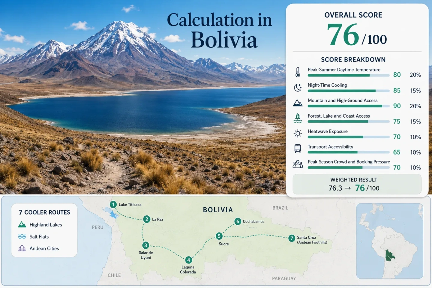
Bolivia Cold-Highland Routes: Altiplano Lakes, Salar Landscapes and Andean Cities
Bolivia’s January–February highland routes replace lowland summer heat with thin-air sunshine, cool afternoons and sharply colder nights. Lake Titicaca softens some temperature swings, Uyuni and Southern Lípez add exposed salar and volcanic-plateau conditions, while La Paz, Oruro and Potosí provide indoor services that remote routes cannot. Heat relief is strong across the route set, but mild-weather comfort is not guaranteed: rain-season road changes, high ultraviolet exposure, altitude and limited shelter can matter more than the daytime maximum.
Lake shores, high cities, volcanic plateaus, salar surfaces and the Southern Lípez lagoon corridor carry equal weight.
Bolivia’s austral summer brings the warmest highland afternoons and the greatest wet-season route variability.
Even the urban bases begin at elevations that require a slower first-day pace.
Mixed station and conservative proxy inputs keep every selected route below the warm-weather scoring ceiling.
The route set cools well after sunset, but several nights fall below the site’s ideal comfort band.
Long four-wheel-drive stages, limited fuel resilience and sparse heated lodging create the largest planning burden.
Lake Titicaca, Sajama, Uyuni and the Southern Lagoon Spine
The markers connect the northern lake-and-city highlands with the western volcanic plateau, central Altiplano stops and the southern salar-lagoon corridor. Marker positions are planning centers rather than guaranteed viewpoints, legal parking areas or trailheads.
Use the named Google Maps links in each route card for broader orientation and confirm current road, weather and access conditions locally before departure.
Bolivia Cold-Highland Suitability Score
This transparent editorial suitability index uses disclosed climate, landscape, access and pressure factors. It is not an official climate classification, a medical altitude rating or a weather forecast.
Very strong daytime heat relief is offset by nights that are colder than the ideal comfort band, limited lake-or-forest access on several routes and difficult transport in the far southwest.
Method: Median of January–February average daily maximum inputs, normalized with the fixed site thresholds.
Route values: La Paz–El Alto 15.0°C; Copacabana–Lake Titicaca 15.0°C; Tuni–Condoriri Lakes 15.0°C; Sajama–Curahuara 19.2°C; Oruro–Central Altiplano 19.2°C; Uyuni–Colchani–Incahuasi 18.5°C; Southern Lípez–Eduardo Avaroa 18.5°C; Potosí–Cerro Rico Highlands 15.8°C. Median: 17.2°C.
Station and proxy mapping: El Alto public station summary for La Paz, Copacabana and Tuni; Oruro summary for Oruro and conservative Sajama representation; Potosí summary for Potosí; Uyuni and central Altiplano public climatology inputs for Uyuni and Southern Lípez. Public summary pages do not publish a consistent station-code field. No lapse-rate correction was applied to higher remote routes, keeping the comparison conservative.
Period: Official 1991–2020 normals where published, supplemented by public 1992–2021 station summaries.
Sources: SENAMHI January climate monitoring; SENAMHI February climate monitoring; NASA POWER climatology documentation; La Paz station summary; Oruro station summary; Potosí station summary.
Method: Median of January–February average daily minimum inputs. The scoring band rewards comfortable night relief rather than the coldest possible night.
Route values: La Paz–El Alto 4.4°C; Copacabana–Lake Titicaca 4.4°C; Tuni–Condoriri Lakes 4.4°C; Sajama–Curahuara 6.1°C; Oruro–Central Altiplano 6.1°C; Uyuni–Colchani–Incahuasi 4.5°C; Southern Lípez–Eduardo Avaroa 4.5°C; Potosí–Cerro Rico Highlands 5.3°C. Median: 4.5°C, normalized to 38/100.
Interpretation: Strong cooling exists throughout the portfolio, but the median sits below the 10–16°C comfort band. Unheated rooms, exposed evening waits and early departures can therefore feel substantially colder than the overall score suggests.
Period and mapping: The same climate baselines and direct or representative station pairings used for the daytime factor.
Sources: SENAMHI January climate monitoring; SENAMHI February climate monitoring; NASA POWER temperature parameters.
Method: Fixed categorical access rubric applied to each route; route-score median used for the factor.
Route scores: La Paz–El Alto 100; Copacabana–Lake Titicaca 100; Tuni–Condoriri Lakes 100; Sajama–Curahuara 100; Oruro–Central Altiplano 100; Uyuni–Colchani–Incahuasi 100; Southern Lípez–Eduardo Avaroa 100; Potosí–Cerro Rico Highlands 100. Median: 100.
Raw category: Every sleeping base is above 900 m; most are above 3,600 m. This factor measures physical access to high ground, not acclimatization safety or road ease.
Period: Access and elevation review, July 2026.
Sources: UNESCO Sajama elevation profile; UNESCO City of Potosí; Ramsar Los Lípez highland wetlands summary.
Method: Fixed access rubric based on a large lake, major river system, broad forest or coast reachable within the stated time band. Salar surfaces are not counted as lakes.
Route scores: La Paz–El Alto 15; Copacabana–Lake Titicaca 75; Tuni–Condoriri Lakes 75; Sajama–Curahuara 15; Oruro–Central Altiplano 45; Uyuni–Colchani–Incahuasi 0; Southern Lípez–Eduardo Avaroa 75; Potosí–Cerro Rico Highlands 0. Median: 30.
Raw category: Strong water access is concentrated at Titicaca, the Condoriri lake system and the Lípez lagoons. Oruro receives limited credit for the Uru Uru wetland system; Uyuni receives none because a salt flat is not a qualifying lake.
Period: Geographic access review, July 2026.
Sources: Ramsar wetland summaries for Bolivia; Eduardo Avaroa protected-area decree.
Method: Official target-month threshold-frequency fallback. A common downloadable daily series with matched coverage for all eight remote routes was not available, so no exact ten-summer daily count is claimed.
Route values: All eight representative highland station or conservative proxy inputs remain in the lowest published 30°C-exceedance category for January–February. Median category: less than 1% of target-window days at or above 30°C, normalized to 100/100.
Coverage note: Monthly means were not treated as heatwave counts. The fallback uses official climatological threshold behavior and conservative representative stations; remote high-elevation routes were not warmed by an artificial lapse-rate adjustment.
Period: Official climatological threshold-frequency fallback available at review time.
Sources: SENAMHI January climate monitoring; SENAMHI February climate monitoring; NASA POWER climatology service documentation.
Method: Fixed transport rubric, scoring routine public access, transfer burden and vehicle dependence; route-score median used.
Route scores: La Paz–El Alto 100; Copacabana–Lake Titicaca 60; Tuni–Condoriri Lakes 60; Sajama–Curahuara 40; Oruro–Central Altiplano 100; Uyuni–Colchani–Incahuasi 60; Southern Lípez–Eduardo Avaroa 20; Potosí–Cerro Rico Highlands 100. Median: 60.
Raw categories: Urban routes have scheduled air or bus access; Copacabana and Tuni require road transfers; the salar needs a suitable vehicle beyond Uyuni; Southern Lípez depends on long, complex four-wheel-drive stages with limited alternatives.
Current-access context: National advisories reviewed on July 25, 2026 warn that roadblocks and fuel shortages can disrupt long-distance travel with little notice. Temporary disruption is not scored as a permanent route closure, but it increases the need for schedule slack.
Sources: NAABOL flight schedules; Mi Teleférico transit information; U.S. Bolivia travel advisory; UK Bolivia safety and security advice.
Method: Fixed categorical fallback using documented visitor concentration, major-event pressure, vehicle-tour capacity and lodging constraints where route-comparable occupancy was unavailable.
Route scores: La Paz–El Alto 60; Copacabana–Lake Titicaca 60; Tuni–Condoriri Lakes 80; Sajama–Curahuara 80; Oruro–Central Altiplano 20; Uyuni–Colchani–Incahuasi 40; Southern Lípez–Eduardo Avaroa 40; Potosí–Cerro Rico Highlands 80. Median: 60.
Raw categories: February Carnival demand heavily reduces Oruro capacity; Uyuni mirror-season tours and the limited Southern Lípez lodging-and-vehicle pool create advance-booking pressure; Sajama and Tuni generally retain lower mass-market pressure.
Period: Latest available hotel and tourism context through 2025, reviewed July 2026.
Sources: INE Bolivia hotel statistics; Bolivia tourism authority Uyuni context.
Each route carries equal weight. Factor values use route medians, so an unusually cold, accessible or crowded destination cannot dominate the national route-set result. Route count adds no bonus.
Eight Routes Across Bolivia’s High Plateau Systems
The portfolio moves from service-rich city bases to lake shores, glaciated headwaters, volcanic national-park terrain, the Uyuni salt flat and the remote lagoons near the Chilean frontier. Temperatures are representative score inputs rather than forecasts.
La Paz–El Alto: Urban Services Across a Steep Altitude Gradient
La Paz descends through a deep basin while El Alto occupies the exposed plateau above it. That vertical arrangement creates one of the route set’s clearest city-scale comfort differences: sunny lower-basin streets can feel milder, but airport arrivals, evening transfers and open El Alto platforms remain colder and windier.
Works for: Travelers who need hospitals, heated interiors, food services and multiple onward connections while remaining in a genuinely cool highland climate.
Copacabana–Lake Titicaca: Water-Moderated but Wind-Exposed
Elevation: about 3,841 m. Representative January–February input: 15.0°C daytime and 4.4°C at night. Access: road connection from La Paz, followed by local boat services where operating conditions allow.
The lake gives this route a different thermal character from the salar: afternoons can remain bright and breezy rather than desert-dry, while the large water body moderates some extremes. Open waterfronts still lose comfort quickly when wind, rain and low cloud arrive together.
Tuni–Condoriri Lakes: Higher, Colder and Less Sheltered
Tuni and the Condoriri lake basin rise above roughly 4,400 m, placing the route well above its representative El Alto climate station. The 15.0°C / 4.4°C score input therefore acts as a conservative proxy rather than a promise of local warmth. Cloud buildup, hail, wind and rapid shade cooling matter more here than city forecasts.
Sajama–Curahuara: Volcanic Cold with Thermal Contrasts
Sajama National Park spans roughly 4,200–6,600 m, yet the route also contains hot springs and geothermal features. Warm water is a local experience, not evidence of a warm route. The surrounding puna remains open, high and vulnerable to wind-driven cooling after cloud or sunset.
Oruro–Central Altiplano: The Practical Plateau Stop
At about 3,735 m, Oruro provides a service city between La Paz, Sajama and Uyuni rather than a remote nature base. The representative January–February input is 19.2°C by day and 6.1°C at night, with regular indoor recovery options that make the same cold easier to manage than in the open salar corridor.
Its route value changes sharply around Carnival. February event demand can compress rooms, transport and street access even though the broader central Altiplano remains spacious.
Uyuni–Colchani–Incahuasi: The Salar Surface Changes the Route
Route-center elevation: about 3,656 m. Representative summer input: 18.5°C / 4.5°C. Vehicle requirement: Uyuni town can be reached by scheduled transport, but salar travel needs a suitable vehicle and current local surface knowledge.
January–February water can create the mirror surface associated with Uyuni, but it can also block or reroute access to Incahuasi and other crossings. A dry-surface plan and a mirror-surface plan are not interchangeable itineraries.
Southern Lípez–Eduardo Avaroa: Maximum Exposure and Minimum Redundancy
Laguna Colorada sits above roughly 4,200 m, while passes and geothermal areas climb higher. The 18.5°C / 4.5°C Uyuni proxy is deliberately conservative because the corridor is generally higher and more exposed. January rain can turn tracks, washouts and lagoon approaches into a route-management problem rather than a simple scenery decision.
Potosí–Cerro Rico Highlands: A Cold City Rather Than a Remote Camp
Potosí stands around 4,000 m and combines steep streets, dense masonry, scheduled transport and a full city-service base. Its January–February station input averages about 15.8°C by day and 5.3°C at night, making it cooler than Oruro while retaining more recovery options than Sajama or Southern Lípez.
The altitude turns ordinary uphill walking into a meaningful exertion factor. Potosí works as a serviced stage before Uyuni, but it is not a low-elevation acclimatization stop.
Lake, Salar and City Cold Do Not Behave Alike
Bolivia’s highland temperature numbers conceal three distinct comfort systems. The same 16–19°C afternoon can feel sheltered, wind-cut or intensely sun-exposed depending on water, surface and service access.
Titicaca and Condoriri Lake Cooling
Lake Titicaca adds moisture, breeze and a degree of thermal moderation; Condoriri adds altitude and much less shelter. Neither behaves like a warm lakeside summer. Wind direction, cloud and the distance to an indoor base often decide comfort more than the daily maximum.
Uyuni’s Open-Surface Cooling
The salar provides almost no shade and can create strong reflected-light exposure by day. After sunset, dry air and an unobstructed horizon favor rapid radiative cooling. The white surface itself should not be treated as the cause of the regional climate; elevation, season and atmospheric dryness do the larger work.
Andean City Recovery
La Paz, Oruro and Potosí pair cold highland air with restaurants, transport terminals, clinics and more dependable indoor shelter. That service layer changes trip resilience without changing the underlying altitude. El Alto’s exposed plateau and Potosí’s steep streets still make wind and exertion prominent.
January Rain Rewrites Uyuni and Southern Lípez
Austral summer is the correct scoring window for Bolivia, but it is not the simplest overland season. Water on the salar, convective cloud over the Cordillera and damaged high-desert tracks change what can be reached, not merely what the landscape looks like.
| Highland system | January–February effect | Route decision | Main fallback |
|---|---|---|---|
| Lake Titicaca | More cloud, showers and wind shifts; water moderates some temperature swings. | Keep boat-dependent plans flexible and retain a shore-based alternative. | Copacabana town or a return to La Paz. |
| Tuni–Condoriri | Afternoon cloud, hail or rain can close the comfort window earlier than a city forecast suggests. | Use an early start and a conservative turnaround point. | Lower urban day around La Paz–El Alto. |
| Salar de Uyuni | Shallow water may create mirror conditions while restricting island and cross-salar access. | Book by surface condition, not by a fixed attraction checklist. | Edge-of-salar routes around Colchani or Uyuni. |
| Southern Lípez | Track condition, washouts and long wet stretches can alter travel time and overnight sequence. | Add schedule slack and avoid tight same-day onward connections. | Shorter Uyuni-based salar program. |
| Oruro | Rain combines with major February event pressure in Carnival periods. | Separate ordinary-season availability from event-week capacity. | La Paz or Potosí service base, depending on route direction. |
Build the Journey Around Sleeping Altitude, Not Only Distance
Northern Sequence
La Paz basin, Lake Titicaca and Tuni–Condoriri may look close on a map, but none is a low-altitude start. An El Alto airport arrival begins above 4,000 m, and Condoriri increases both elevation and exposure. A short urban transfer does not equal a gradual ascent.
Southern Sequence
Potosí, Uyuni and Southern Lípez form a logical geographic progression, yet the sleeping profile remains high throughout. Moving from Uyuni into the lagoon corridor adds remoteness and often adds elevation; symptoms or fatigue should not be answered by continuing upward automatically.
Sucre’s Transition Role
Sucre is not part of the scored cold-highland set because it sits lower and warmer, but that difference can be useful. It offers a more gradual approach before Potosí for overland itineraries, without pretending to remove altitude risk once the route reaches the Altiplano.
Eight Routes Compared by Heat Relief, Water and Access
All eight scored routes appear in the same decision matrix. Temperature entries are representative factor inputs; access notes reflect the route beyond the named city or service base.
| Route | Approximate base elevation | Jan–Feb day / night input | Cooling identity | Access pattern | Primary trade-off |
|---|---|---|---|---|---|
| La Paz–El Alto | 3,640–4,061 m | 15.0°C / 4.4°C | Urban altitude and basin gradient | Air, bus and cable-car network | Immediate high-elevation arrival |
| Copacabana–Lake Titicaca | About 3,841 m | 15.0°C / 4.4°C | Large-lake moderation and wind | Road transfer; local boats | Exposed shore and variable boat conditions |
| Tuni–Condoriri Lakes | About 4,430 m+ | 15.0°C / 4.4°C proxy | High lakes and Cordillera exposure | Arranged road transfer; walking access | Little shelter and rapid weather change |
| Sajama–Curahuara | About 4,200 m | 19.2°C / 6.1°C proxy | Volcanic plateau, wind and geothermal contrast | Long road approach; sparse local services | Warm springs can mask a cold overnight setting |
| Oruro–Central Altiplano | About 3,735 m | 19.2°C / 6.1°C | Open plateau with city recovery | Scheduled intercity transport | February Carnival capacity pressure |
| Uyuni–Colchani–Incahuasi | About 3,656 m | 18.5°C / 4.5°C proxy | Open salar and strong evening cooling | Scheduled access to Uyuni; vehicle on salar | Water depth changes crossings and island access |
| Southern Lípez–Eduardo Avaroa | 4,200–4,900 m route band | 18.5°C / 4.5°C conservative proxy | Lagoon, volcano and high-desert exposure | Multi-day four-wheel-drive corridor | Few fuel, lodging and route alternatives |
| Potosí–Cerro Rico Highlands | About 4,000 m | 15.8°C / 5.3°C | Dense highland city and cold nights | Scheduled city transport | Steep streets add exertion at altitude |
Roadblocks, Fuel and the Cost of Remoteness
Access status was reviewed on July 25, 2026. Long-distance Bolivian road travel can be interrupted by demonstrations, blockades or fuel shortages with limited warning. The consequence grows toward Sajama, Uyuni and Southern Lípez because alternate roads, heated waiting areas and same-day replacement vehicles become progressively scarcer.
Urban Redundancy
La Paz–El Alto, Oruro and Potosí have the strongest combinations of terminals, lodging and alternative departure days. Disruption still matters, but an unplanned night usually remains an indoor city problem rather than an exposed-road problem.
Salar Vehicle Dependence
Uyuni town can retain scheduled connections while the salar itself becomes inaccessible to the original plan. Surface water, driver availability, fuel and vehicle condition should be treated as separate checks.
Southern Lípez Has Little Redundancy
A delay in the far southwest can change several nights at once because lodging and fuel stops are linked in sequence. Keep the onward flight, international border connection or fixed hotel night away from the final remote driving day.