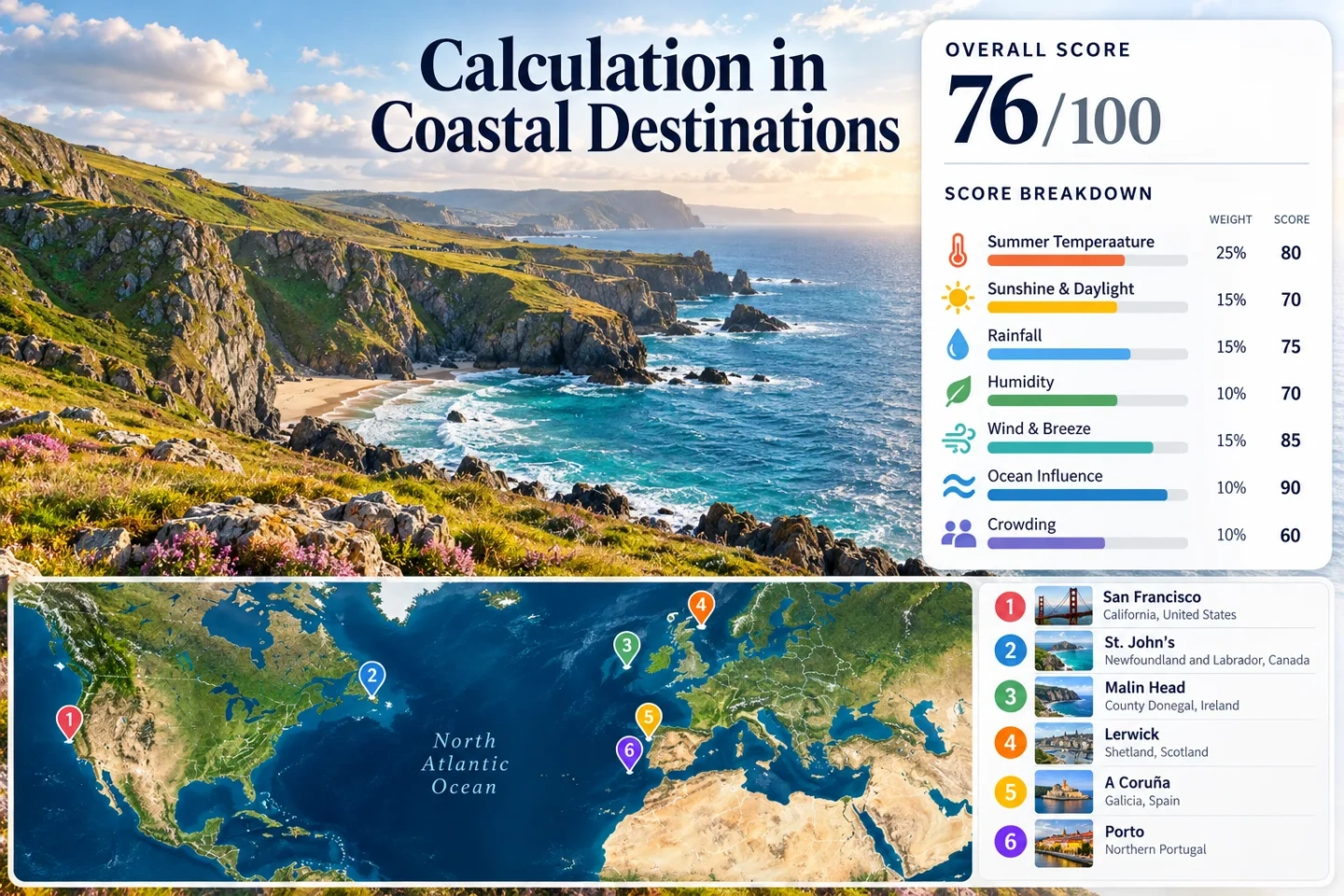
Cooler Coastal Destinations: Where Ocean Influence Matters in Summer
Ocean proximity does not automatically mean a cool summer. The effect becomes most useful when relatively cool water, persistent onshore flow, a marine layer, exposed Atlantic air or seasonal upwelling holds daytime temperatures below nearby inland heat. July–August climate normals from six ocean-facing destinations show several versions of that pattern, from the unusually cool summer marine regime around San Francisco and Lerwick to the milder but still noticeable Atlantic moderation of A Coruña and Porto.
The same Northern Hemisphere peak-summer window is used for all six locations.
Pacific, North Atlantic, North Sea-facing and Iberian Atlantic settings are represented.
Simple July–August mean of the published 1991–2020 average daily maxima.
A Coruña and Porto remain ocean-moderated while summer rainfall frequency drops sharply compared with exposed northern Atlantic coasts.
Thermal inertia, sea breezes, persistent marine layers and cold-current or upwelling influence can all reduce coastal daytime heating.
Six Coastlines Where Peak-Summer Ocean Influence Is Easy to Compare
The locations span very different latitudes and ocean settings, so the map is most useful as a planning comparison rather than a ranking. The same six destinations appear in the detailed cards and the climate-normal matrix.
This marker map is built for planning orientation. Marker positions use approximate public location centers, not exact viewpoints, trailheads or legal parking points. Use each destination card for Google Maps links and local access context before traveling.
Six Different Ways the Ocean Changes a Summer Stay
The temperature figures are simple July–August averages calculated from the monthly normals published by the named national meteorological agencies. A Coruña uses AEMET's 1981–2010 normal because that is the period on its standard station-normal page; the other listed stations use published 1991–2020 values. These are climate references, not forecasts for a specific trip.
San Francisco: Cold Upwelling and a Persistent Marine Layer
San Francisco is the clearest example in the set of a coast that can behave very differently from nearby inland California in summer. NOAA describes summer upwelling along the U.S. West Coast and specifically notes that cold coastal water around San Francisco contributes to frequent summer fog. NOAA also describes the Central California marine layer as a temperature-inversion system that can persist for days or weeks rather than appearing only as a short afternoon sea breeze.
The NOAA 1991–2020 normal for San Francisco International Airport is useful as a consistent metropolitan reference, although exposed oceanfront districts can be cooler and foggier than the airport. The main planning lesson is microclimate: a short move inland or above the marine inversion can produce a much warmer afternoon.
San Francisco on Google Maps · NOAA/NCEI 1991–2020 station normals
St. John's: Cool North Atlantic Air with a Larger Weather Trade-Off
St. John's sits on an ocean-exposed edge of Newfoundland where summer warmth is restrained much more than in many continental cities at similar latitudes. Environment and Climate Change Canada's 1991–2020 normal for St. John's Airport lists daily maxima of 20.9°C in July and 20.8°C in August, while the corresponding daily minima are 11.2°C and 12.1°C.
This is a strong low-heat profile, but the Atlantic setting should not be read as guaranteed blue-sky comfort. The practical value is temperature moderation rather than dry-weather certainty. Downtown can work as a compact base, while exposed capes and coastal walks add wind and rapid weather changes to the temperature story.
St. John's on Google Maps · Environment and Climate Change Canada 1991–2020 normals
Malin Head: Atlantic Exposure Keeps the Temperature Range Narrow
At Ireland's far northwestern edge, Malin Head shows how a fully exposed Atlantic location can stay cool even when daylight is long. Met Éireann's published 1991–2020 averages put July and August mean daily maxima at 17.0°C and 17.1°C, with mean daily minima of 12.1°C and 12.4°C.
The trade-off is visible in the same normal set: measurable rain is frequent. That makes Malin Head suitable for travelers who prioritize low daytime heat over a dry-summer pattern. The area is also more road-dependent than the larger city bases in this comparison, so the cool-air advantage comes with a different transport profile.
Lerwick: A High-Latitude Maritime Summer with Very Low Daytime Heat
Lerwick's combination of high latitude and surrounding sea produces the lowest July–August daytime normal in this six-place comparison. The Met Office 1991–2020 station averages show 14.40°C for the July maximum and 14.70°C for August; minimum temperatures average 10.09°C and 10.47°C.
For heat avoidance, the numbers are unusually strong. For a conventional beach holiday, they point in the opposite direction. The ocean influence is not merely a pleasant breeze here; it is part of the dominant summer climate, with wind and rain frequency important enough to shape daily plans.
Lerwick on Google Maps · Met Office 1991–2020 Lerwick averages
A Coruña: Atlantic Moderation without a Cold-Summer Feel
A Coruña is useful because it shows that ocean influence can matter even when the destination does not feel cold. AEMET's published 1981–2010 station normal gives mean daily maxima of 22.1°C in July and 22.8°C in August, with minima of 15.9°C and 16.4°C. The same table reports only about 5.5–5.7 days per month with at least 1 mm of rain in those two months.
The result is a different coastal compromise from Ireland or Shetland: warmer nights, fewer wet days and more reliable summer warmth, while the Atlantic still limits average daytime heat compared with many inland Iberian locations. The urban waterfront and rail-connected city base also make the cooling effect easier to use without building a trip around remote roads.
Porto: Atlantic Influence Moderates Summer, but Hot Days Still Break Through
Porto marks the warmer edge of this comparison. IPMA's 1991–2020 normal for Porto / Pedras Rubras gives mean daily maxima of 24.3°C in July and 24.8°C in August, with mean daily minima of 15.5°C and 15.7°C. Those averages remain moderate, but the same official normal records 3.1 July days and 3.5 August days with maxima of at least 30°C.
That combination is useful for travelers who want a coastal city with relatively moderate averages and a dry summer, but it should not be treated as a low-heat guarantee. Atlantic exposure helps, especially near the coast, while hot continental or easterly episodes can still push temperatures well above the monthly mean.
Porto on Google Maps · IPMA 1991–2020 Porto / Pedras Rubras normal
Daytime Heat, Night Relief and Wet-Weather Trade-Offs
A low average maximum answers only one part of the comfort question. Night temperatures, rain frequency and wind exposure can make two equally cool coasts feel very different. Values shown below use the official station sources linked in the destination cards; July–August max/min figures are simple averages of the two monthly normals.
| Destination | Jul–Aug mean max | Jul–Aug mean min | Ocean-influence signal | Main summer trade-off |
|---|---|---|---|---|
| San Francisco | 22.8°C | 13.2°C | Cold-current upwelling plus persistent marine layer | Fog, wind and sharp neighborhood-to-inland microclimates |
| St. John's | 20.9°C | 11.6°C | Open North Atlantic maritime moderation | Cool, variable weather rather than dry-summer certainty |
| Malin Head | 17.1°C | 12.2°C | Highly exposed Atlantic setting | Frequent measurable rain and road-dependent local movement |
| Lerwick | 14.6°C | 10.3°C | High-latitude maritime climate | Wind and rain are integral to the low-heat profile |
| A Coruña | 22.5°C | 16.1°C | Atlantic moderation on the Iberian northwest coast | Warmer nights and higher humidity than the northern Atlantic examples |
| Porto | 24.6°C | 15.6°C | Atlantic buffer with a pronounced dry-summer regime | Several 30°C+ days remain normal in July and August |
Why San Francisco's Coast Is a Special Case
Summer Upwelling Replaces Surface Water with Colder Water
NOAA explains that summertime winds along the U.S. West Coast can move surface water offshore and allow colder subsurface water to rise. In the San Francisco area, that seasonal upwelling contributes to cold coastal water and frequent summer fog. This is stronger than the generic idea that any coastline receives a cooling breeze.
The Marine Layer Can Persist Instead of Resetting Each Afternoon
NOAA's marine-layer explanation distinguishes the West Coast inversion from a simple daily sea-breeze cycle. Cool air trapped below warmer air aloft can remain near the California coast for days or weeks. That is why coastal San Francisco can stay gray and cool while places only a short distance inland or above the inversion become much warmer.
The North Atlantic Examples Trade Heat for Wind, Rain and Variability
St. John's, Malin Head and Lerwick all post low peak-summer temperature normals, but the travel experience is not interchangeable. Lerwick is the coldest by daytime normal and also the windiest of the two European station examples with wind data shown here. Malin Head combines a roughly 17°C July–August mean maximum with about 15.7 days per month reaching at least 1 mm of rain. St. John's is warmer than either but still stays near a 21°C mean daytime maximum.
Choose Lerwick When Low Daytime Heat Matters More than Beach Warmth
A 14.6°C July–August mean maximum is a fundamentally cool summer regime. Long daylight helps outdoor planning, but wind and passing rain should be treated as normal conditions rather than unusual interruptions.
Choose Malin Head for Atlantic Exposure with Slightly Milder Afternoons
Malin Head raises the daytime normal by only a few degrees compared with Lerwick while retaining frequent wet days. It suits a road-based coastal itinerary where low heat has higher priority than dry-weather reliability.
Choose St. John's for a City Base with Cool Maritime Averages
St. John's offers the most urban base of these three northern Atlantic options. Its roughly 21°C July–August daytime normal is still low, but the city format provides more indoor fallback choices when the ocean-facing weather turns damp or windy.
A Coruña and Porto Show Where the Ocean Buffer Stops Being a Cool Guarantee
Northwestern Iberia is useful for travelers who want a compromise rather than the coldest possible summer. A Coruña's July–August mean maximum is about 22.5°C in AEMET's 1981–2010 normal, while Porto / Pedras Rubras reaches about 24.6°C in IPMA's 1991–2020 normal. Both remain moderate by Iberian summer standards, but their warmer nights and lower rainfall frequency produce a very different feel from Ireland, Shetland or Newfoundland.
A Coruña Keeps Daytime Heat Moderate without a Very Wet Summer Pattern
Only about 5.5–5.7 days per month reach at least 1 mm of rain in July and August in the AEMET normal. That makes A Coruña a useful middle ground for travelers who want Atlantic moderation but do not want to build every day around frequent rain.
Porto Needs a Heat-Episode Backup Plan
The 24.3–24.8°C normal maxima can look mild on paper, yet IPMA also reports roughly three to four 30°C+ days per month in July and August at Porto / Pedras Rubras. A coastal stay can reduce average heat without eliminating short hot spells.
Ocean Cooling Works Only While Marine Air Reaches the Place You Are Staying
NOAA's sea-breeze explanation starts with a simple physical contrast: land heats more quickly than water during the day, so cooler, denser marine air can move inland beneath rising warm air. The practical limit is distance and topography. A hotel beside the waterfront, a neighborhood behind a coastal ridge and an inland valley can experience the same regional forecast very differently.
Immediate Shoreline
Ocean temperature, wind direction and low cloud have the strongest direct influence. San Francisco's western neighborhoods are an extreme example because the marine layer can remain entrenched rather than arriving only as an afternoon breeze.
Coastal City Base
Places such as A Coruña and Porto can keep a clear maritime signature while still experiencing warmer urban afternoons. A short ride toward exposed beaches may feel cooler; a move inland can remove much of that buffer.
Inland Fade
Sea-breeze penetration depends on the larger wind pattern and terrain. Mountains, strong offshore flow or a shallow marine layer can limit how far cooler air travels, so “coastal region” is too broad a label for trip-day decisions.
Match the Coast to the Kind of Summer Relief You Actually Want
| Travel priority | More suitable examples from this set | What changes the decision |
|---|---|---|
| Lowest daytime heat | Lerwick, Malin Head | Wind and wet-day frequency become part of the daily routine. |
| Cool city base | St. John's, San Francisco | Both have strong local weather variability; San Francisco's microclimates are especially sharp. |
| Moderate warmth with fewer wet days | A Coruña | Nights are warmer than the northern Atlantic examples, and humidity can remain noticeable. |
| Drier Atlantic city with ocean access | Porto | Normal summer conditions still include several 30°C+ days per month. |
| Strongest cold-water microclimate contrast | San Francisco | Where you stay relative to the shoreline, coastal gaps and inversion can matter as much as the city name. |